Picture yourself sipping coffee as manatees glide past or heading out for a sunset run to the Gulf. If you are considering a waterfront home in Crystal River, the choices can feel overwhelming at first. The good news is you can narrow your search quickly once you understand how riverfront, canal, and spring‑adjacent properties differ. In this guide, you will learn the key lifestyle and boating tradeoffs for each option, what to check before touring, and how to line up the right permits and pros for a smooth purchase. Let’s dive in.
Riverfront and bayfront basics
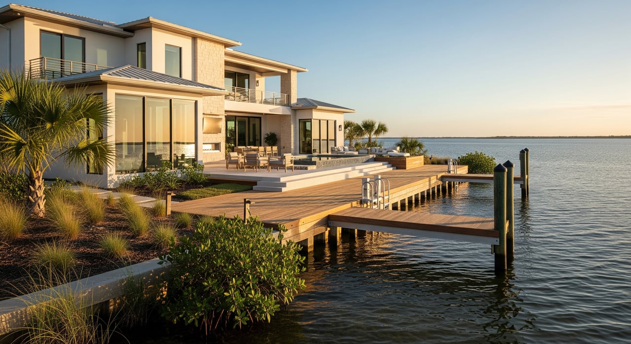
Riverfront and bayfront homes sit on the main Crystal River channel and King’s Bay. These properties usually have deeper water at the dock than most canals. You also get more direct routes to open water, which helps if you own a larger or deeper‑draft boat and want fewer tight turns. Expect more tidal influence and salt content than you will see near spring pools.
Because you are on the main waterways, you will notice more boat traffic and wakes, especially around busy times. Many riverfront locations sit near marinas, launch ramps, and services, which makes fueling and maintenance simple. If you value quick access to the Gulf and own a boat that needs depth, riverfront and bayfront often check the right boxes.
Canal living: quiet and convenient
Canal homes sit on side canals that feed into the river or bay. The big draw is shelter and privacy. Canals often feel quieter, with less traffic and reduced wind and wave exposure. They can be a great match for buyers who want a peaceful setting and easy access for smaller boats, kayaks, and paddleboards.
Depth and width vary widely from canal to canal. Some canals handle center consoles without issue, while others work best for shallow‑draft vessels only. Sediment buildup can be a reality in some areas, and periodic dredging may be needed. Dock spacing is closer to neighbors, and you will want to confirm local rules on dock length and placement before you plan upgrades.
Spring‑adjacent properties and sanctuaries
Homes near the famous springs of King’s Bay, including the Three Sisters Springs area within the Crystal River National Wildlife Refuge, offer exceptional water clarity and cooler spring temperatures. The setting is stunning, with frequent kayak and paddleboard activity and seasonal manatee viewing.
With that beauty comes stronger environmental protections. You will find no‑wake zones, speed limits, and seasonal closures near spring openings and within refuge boundaries. Motorized access can be limited in certain areas, especially during manatee season. For many buyers, the visual and lifestyle premium is worth these tradeoffs, but it is important to go in with eyes open about the rules.
Boating and navigation factors
Depth at your dock
Depth should be verified at mean low water, not just at high tide. You also want to confirm the depth and condition of the access channel between your dock and the main river or bay. If you run a deeper‑draft boat, riverfront or a well‑dredged canal is usually the safer bet. Shallow‑draft boats, kayaks, and paddleboards are more flexible across canals and spring runs.
What to do next:
- Ask the seller or HOA about sedimentation history and any dredging schedule.
- Review charted depths and talk to local marinas about real‑world conditions.
Bridge and vertical clearance
Fixed bridges, powerlines, and other overhead obstacles can limit air draft for sailboats and taller center consoles. You should confirm vertical clearance at mean high water and note any nearby overhead utilities.
What to do next:
- Identify any bridges between the property and King’s Bay or the river mouth.
- Verify clearances using official bridge tables or county information and compare to your boat’s height.
Travel time to open water
Your route to the Gulf depends on distance, no‑wake or manatee speed zones, and the number of turns through canals or channels. A straight riverfront run can save time. A winding canal may look close on a map but take longer at legal speeds.
What to do next:
- Map routes and factor realistic cruising speeds and posted restrictions.
- Speak with local boaters or marinas for typical transit times at legal speeds.
Wake zones and seasonal rules
Around Crystal River, there are manatee protection areas with slow or no‑wake rules, especially near springs and aggregation spots in winter. You may also see no‑wake buffers near marinas and shorelines. The Florida Fish and Wildlife Conservation Commission manages manatee protection and speed zones, and the U.S. Fish & Wildlife Service enforces rules inside the refuge.
What to do next:
- Check current speed zones and seasonal restrictions before you buy.
- Plan your boating with these rules in mind to avoid delays or violations.
Traffic and recreational use
Spring areas draw swimmers, kayakers, paddleboarders, and tour operators. Riverfront and bayfront inlets near launches and marinas can see more larger boat traffic. If you prefer a calmer setting, a quieter canal may be a better match.
Docks, lifts, and permits
Who approves what
Waterfront improvements often require approval from several agencies. The Florida Department of Environmental Protection typically handles structures over sovereign submerged lands and some shore‑protection work. Citrus County manages local building and dock permits, electrical, and inspections. The U.S. Army Corps of Engineers may be involved for work in navigable waters or wetlands, and the U.S. Fish & Wildlife Service has authority inside or near the Crystal River National Wildlife Refuge and spring sanctuaries.
Practical tip: Ask for copies of existing permits and final inspections for docks, lifts, and seawalls. Unpermitted or noncompliant structures can be costly to fix.
Dock and lift choices
- Floating docks: Adjust to water level changes and can work well where tidal swings occur or depth varies.
- Fixed pile docks: Stable for heavier boats, but may require deeper pilings and more permitting.
- Boat lifts: Common in brackish and salt‑influenced areas to reduce marine growth and corrosion. Lifts require proper engineering, electrical work, and permits.
Also consider dock length, placement, and setbacks from property lines and channels. Shade impacts on submerged vegetation may trigger additional conditions or mitigation.
Seawalls and canal maintenance
Ask about the seawall’s age, material, and condition. Concrete, wood, and riprap each have different maintenance profiles. If you are targeting canals, ask whether the canal is county‑maintained, HOA‑maintained, or private. The long‑term plan for dredging matters for depth‑sensitive vessels.
Environmental protections
Crystal River’s springs and surrounding habitats support manatees and seagrass beds that are protected. Speed restrictions, seasonal closures, and limitations on motors or anchoring can apply near springs. Dock placement and boat use that might shade or damage seagrass can be limited or require mitigation. Water‑quality protections may affect septic systems, runoff, and boat maintenance practices.
Quick screening checklist
Use this list to sort listings before you schedule showings:
- Property type: riverfront, canal, or spring‑adjacent.
- Water depth at dock at mean low water (in feet, if available).
- Depth and maintenance of the access channel. Any recorded easements or community dredging agreements?
- Bridges or overhead obstructions en route. Vertical clearance at mean high water.
- Known no‑wake or manatee zones between the dock and the river mouth.
- Estimated travel time to the Gulf at legal speeds.
- Dock and seawall permits on file. Any recent repairs or final inspections?
- FEMA flood zone and estimated flood insurance availability/cost.
- HOA rules on docks, lifts, mooring, or signage.
- Proximity to marinas, fuel, and service providers.
Smart questions to ask
Bring these up with sellers, HOAs, or neighbors:
- Has the dock or canal ever been dredged? When and by whom?
- Are there seasonal closures or restrictions that affect boat access from this waterway?
- What permits and repairs exist for the seawall, dock, and lift? Can you share permit numbers and final approvals?
- How much tidal variation occurs here and how does it affect docking at low tide?
- Is the property inside or adjacent to a refuge, sanctuary, or no‑motor area?
- What boat sizes do neighbors typically moor at nearby docks?
Local pros who can help
- Marine surveyor or dock contractor: Evaluate dock condition and suitability for your boat.
- Licensed surveyor or records specialist: Confirm riparian boundaries and any encroachments.
- Permitting search: Pull local and state permits for existing structures.
- Flood and insurance specialist: Confirm elevation certificates, coverage, and cost ranges.
- Local marina operators and longtime boaters: Reality‑check depths, routing, and travel times.
Insurance and resilience
Flood insurance may be required if the home lies in a Special Flood Hazard Area. Premiums and availability vary by elevation, construction, and mitigation features. For wind and hurricane risk, roof condition, shutters, and structural upgrades can affect pricing and eligibility. Many boat and dock policies have specific requirements for lifts, mooring, and maintenance records.
How to match lifestyle to location
- Choose riverfront or bayfront if you want fast, direct access to deeper water and frequently take a larger boat out toward the Gulf.
- Choose a canal if you prefer quiet, sheltered living and run a smaller or shallow‑draft boat, kayaks, or paddleboards.
- Choose spring‑adjacent if you love clear water and nature viewing, and you are comfortable with no‑wake rules and seasonal limits near sanctuaries.
The right fit depends on your boat, how often you plan to get out on the water, and how much you value tranquility versus speed to open water. Start with depth, route, and rules, then confirm permits and maintenance history before you tour.
Ready to talk through your shortlist or set up showings that match your boating style? Reach out to Steven Lenhardt for local insight and a plan tailored to your next move.
FAQs
What is the difference between Crystal River riverfront and canal homes?
- Riverfront and bayfront typically offer deeper water and faster routes to open water, while canals are quieter and more sheltered but can have depth and dredging variability.
Are motorboats allowed near Three Sisters Springs in Crystal River?
- Spring areas within the Crystal River National Wildlife Refuge often have speed limits, no‑wake zones, and seasonal restrictions that can limit or prohibit motorized access near spring openings.
How can I estimate travel time from a Crystal River home to the Gulf?
- Map the route, note no‑wake and manatee zones, and use realistic cruising speeds; confirm typical times with local marinas or experienced boaters.
What permits do I need to add or modify a dock in Citrus County?
- Expect to work with Citrus County for building permits, FDEP for submerged lands or shore work, and possibly the U.S. Army Corps, with USFWS involvement near refuge areas.
What should I check about canal maintenance before buying in Crystal River?
- Ask who maintains the canal, whether there is a dredging plan or schedule, and how sedimentation has affected depth over time.
Do I need flood insurance for a waterfront home in Crystal River?
- If the property is in a FEMA Special Flood Hazard Area, flood insurance is typically required by lenders; costs depend on elevation, construction, and mitigation features.
